Bloor Homes Logo

Land off Hampton Road,
Knowle

Welcome to our website, where you can find out more about Bloor’s emerging proposals for a new residential development immediately north of Knowle, off Hampton Road.

These proposals aim to respond to local housing need. Solihull Borough Council currently faces a shortfall in housing land supply and needs to deliver over 1,300 homes each year to meet demand. There is therefore a clear and pressing need for new homes of all types, including family, affordable and downsizing accommodation.

Our plans seek to help meet this need while also delivering benefits for the existing community. These include new public green space, children’s play areas, and enhancements to local biodiversity. The development would also support investment towards local infrastructure, such as education, healthcare and community facilities, as well as off-site improvements to walking and cycling networks, supporting the wider community and promoting active, sustainable travel choices.

We recently consulted with the community and held a Public Webinar with a Q&A session on Thursday 24th September 2026. We would like to thank everyone who has shown an interest in our proposals, asked us questions and shared their opinions with us.

You can find information on the scheme we consulted on in the Emerging Proposals section and PDF copies of the consultation materials including a recording of the webinar are available in the Library section.

If you would like to receive email updates about this project, please sign up to our mailing list using the Register button below.

Site Location

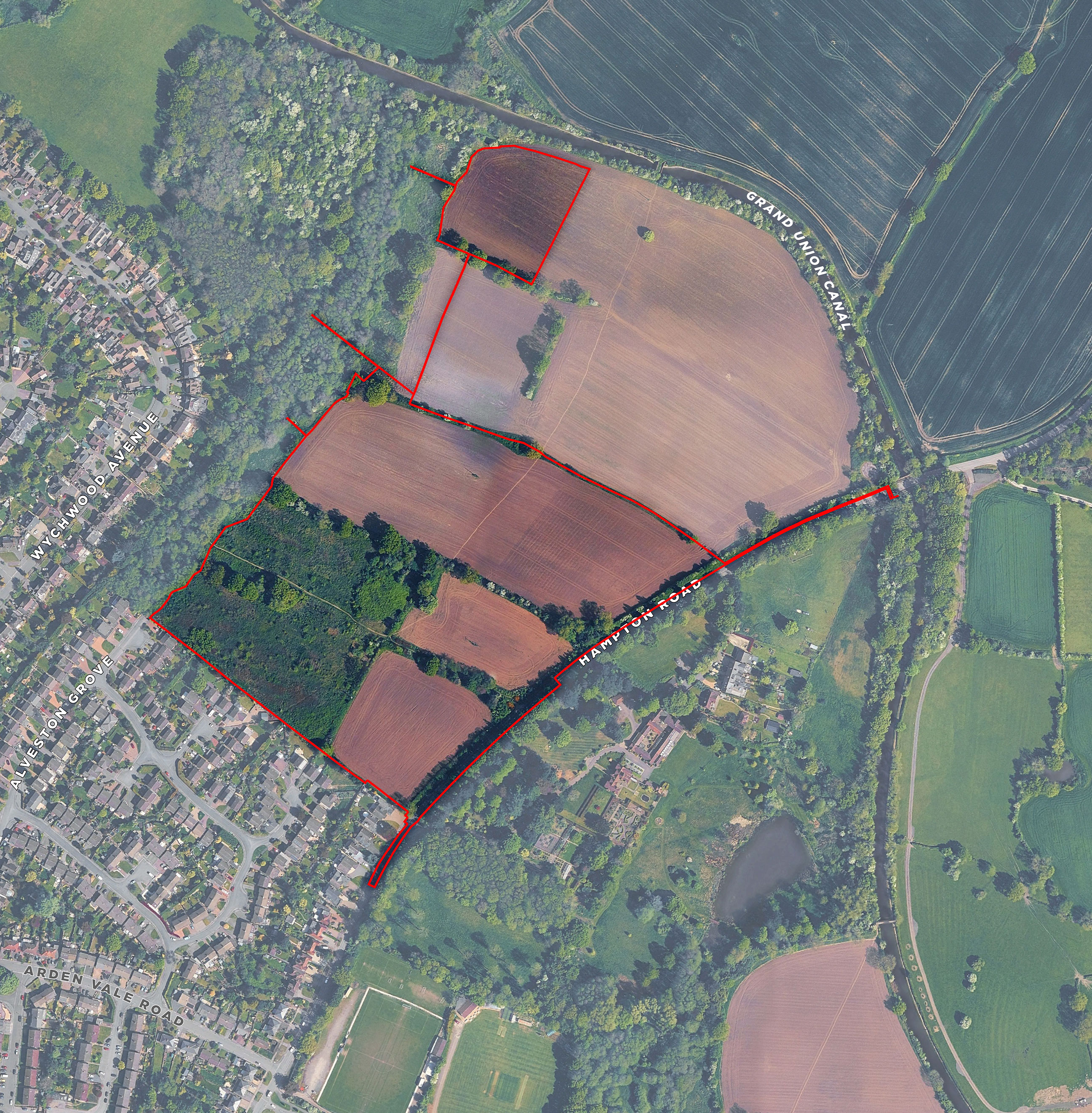
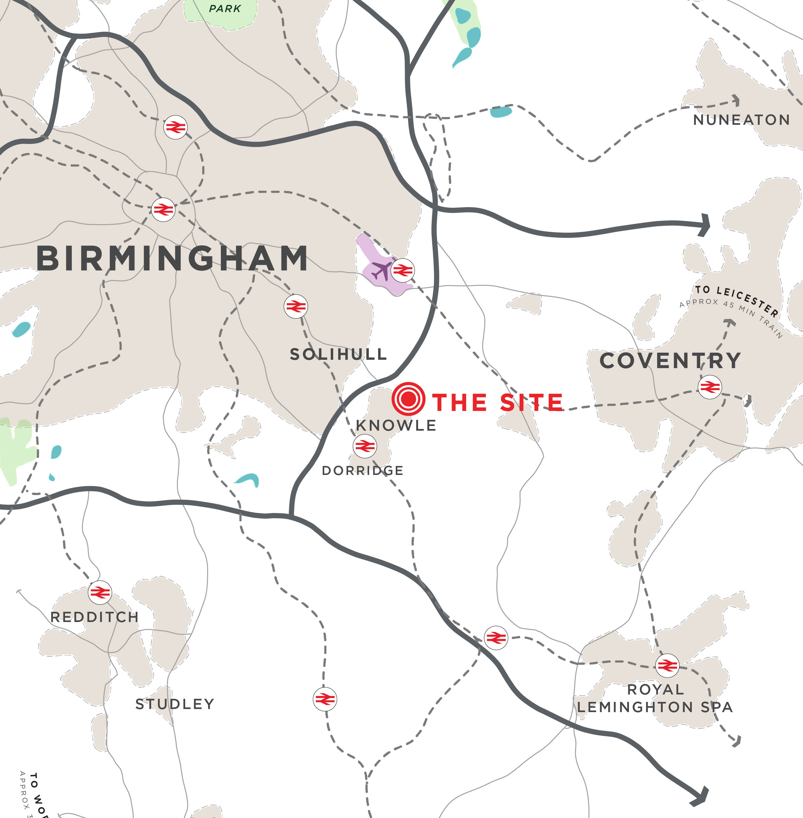
The c.10.6ha site is located northwest of Knowle and to the west of Hampton Road, approximately 1km from the centre of Knowle.

The southern boundary is a hard edge defined by the rear garden fencing of existing residential plots. The eastern boundary is defined by Hampton Road, with the southernmost corner of the site of Hampton Road transitioning into a sub-urban street lined with large detached properties making the site a gateway to Knowle.

The site is bounded by existing woodland and shrubs along the Purnell’s Brook corridor to the west and the open fields to the north which separate the site from the countryside beyond.

Access to the site is currently provided from Hampton Road via a gated accesses to the central section of the site. Pedestrian access is provided in the form of a public footpath, linking Hampton Road to Wychwood Avenue, and the existing residential area of Copt Heath. The site is located on the opposite side of Hampton Road to Grimshaw Hall.

Hoover over image and click the arrows to scroll through the images:

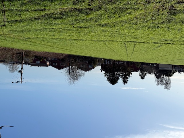
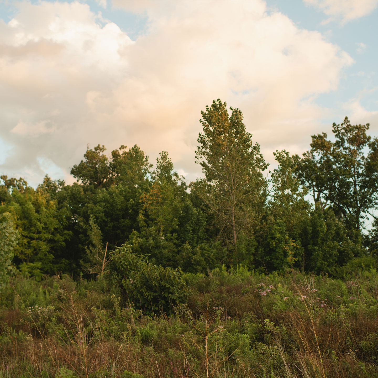
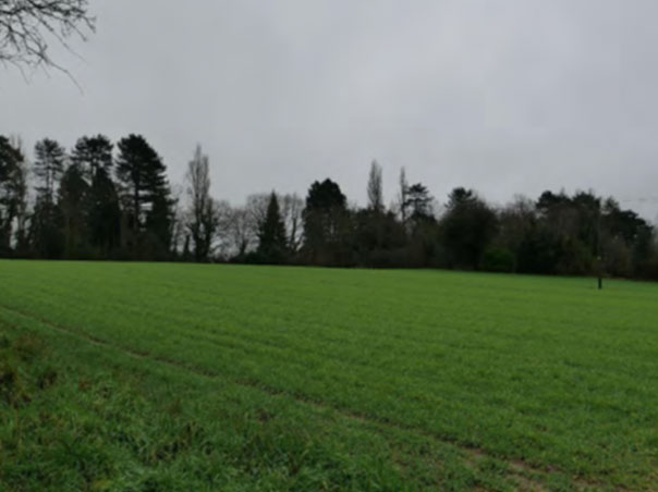
  • View from site looking towards Chantry Heath Crescent

    View from site looking towards Chantry Heath Crescent

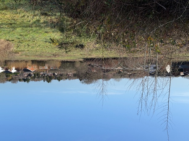
  • View from site looking towards Alveston Grove

    View from site looking towards Alveston Grove

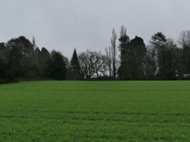
  • View of Grimshaw Hall from centre of site

    View of Grimshaw Hall from centre of site

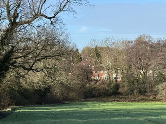
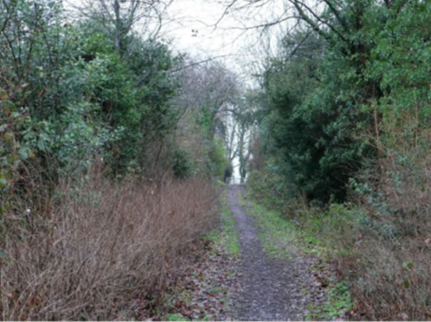
  • View from site looking towards Wychwood Avenue

    View from site looking towards Wychwood Avenue

  • Aerial Location Plan

    Aerial Location Plan (Click to Enlarge)

  • Wider site location plan

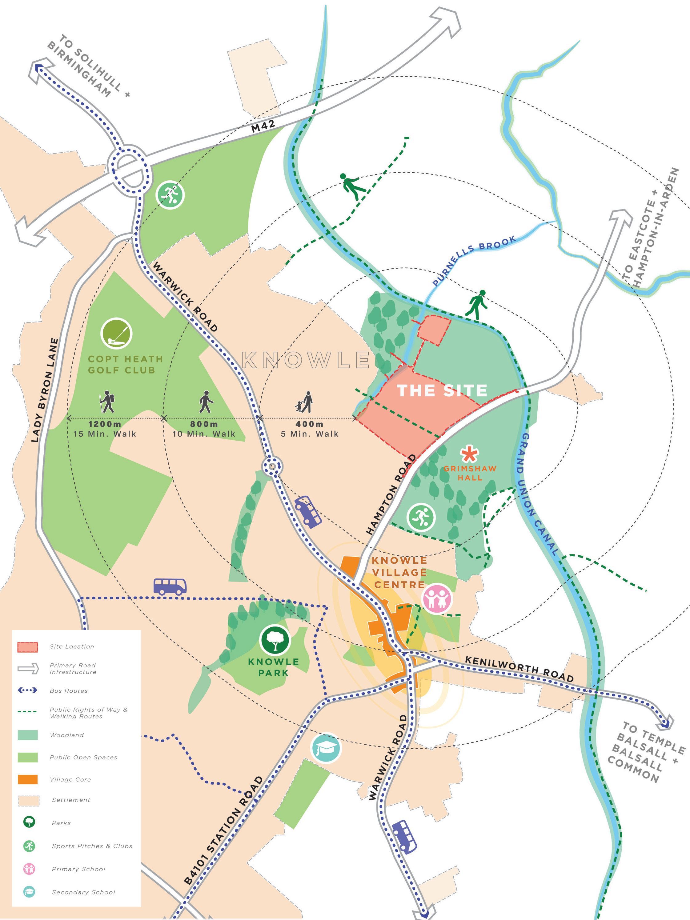
    Wider site location plan (Click to Enlarge)

Background Information

Bloor Homes

Founded in 1969 by John Bloor, Bloor Homes has grown from a family business into one of the UK’s most respected housebuilders – while staying true to the values that shaped its very first home and remaining family owned. Craftsmanship, quality, and care have always been at the heart of everything we do.

More than 50 years on, our commitment remains unchanged. Every home we create is built with meticulous attention to detail, designed not just for today, but for generations to come.

Bloor Homes has a proven track record of delivering high-quality new homes in the West Midlands. We have taken the time to understand the unique characteristics of the site and are committed to creating a thriving community that we would love for ourselves, or our family and friends to live in.

Sustainability is woven into every decision we make – from protecting local wildlife and celebrating heritage, to creating beautiful green spaces that enrich both the landscape and the lives of our homeowners.

You can find out more about Bloor Homes here >

Collage of bloor homes corporate images

98%

would recommend us

96%

satisfaction with our build quality

96%

satisfaction with our buying experience

5-star builder for customer satisfaction

Proud to be Homes for Nature members

Rated 'Excellent' on Trustpilot

Planning Policy Context

Solihull Local Plan

The Solihull Local Plan was adopted in December 2013 and covers the plan period of 2011 – 2028.

In accordance with the NPPF, Solihull Council prepared and submitted a new Local Plan for examination in October 2020. The site was allocated for development under reference KN1A in the 2020 Draft Submission Plan.

The Local Plan was heard at public examination hearings in May 2021. However, following significant changes to national planning policy during this period, the plan was withdrawn from examination in October 2024.

The Council has now commenced preparation of a further replacement plan, known as the Solihull Local Plan 2026–2043. As part of that process, a Call for Sites exercise was undertaken between November 2024 and January 2025. More than 300 housing and employment sites were submitted for consideration, including the application site.

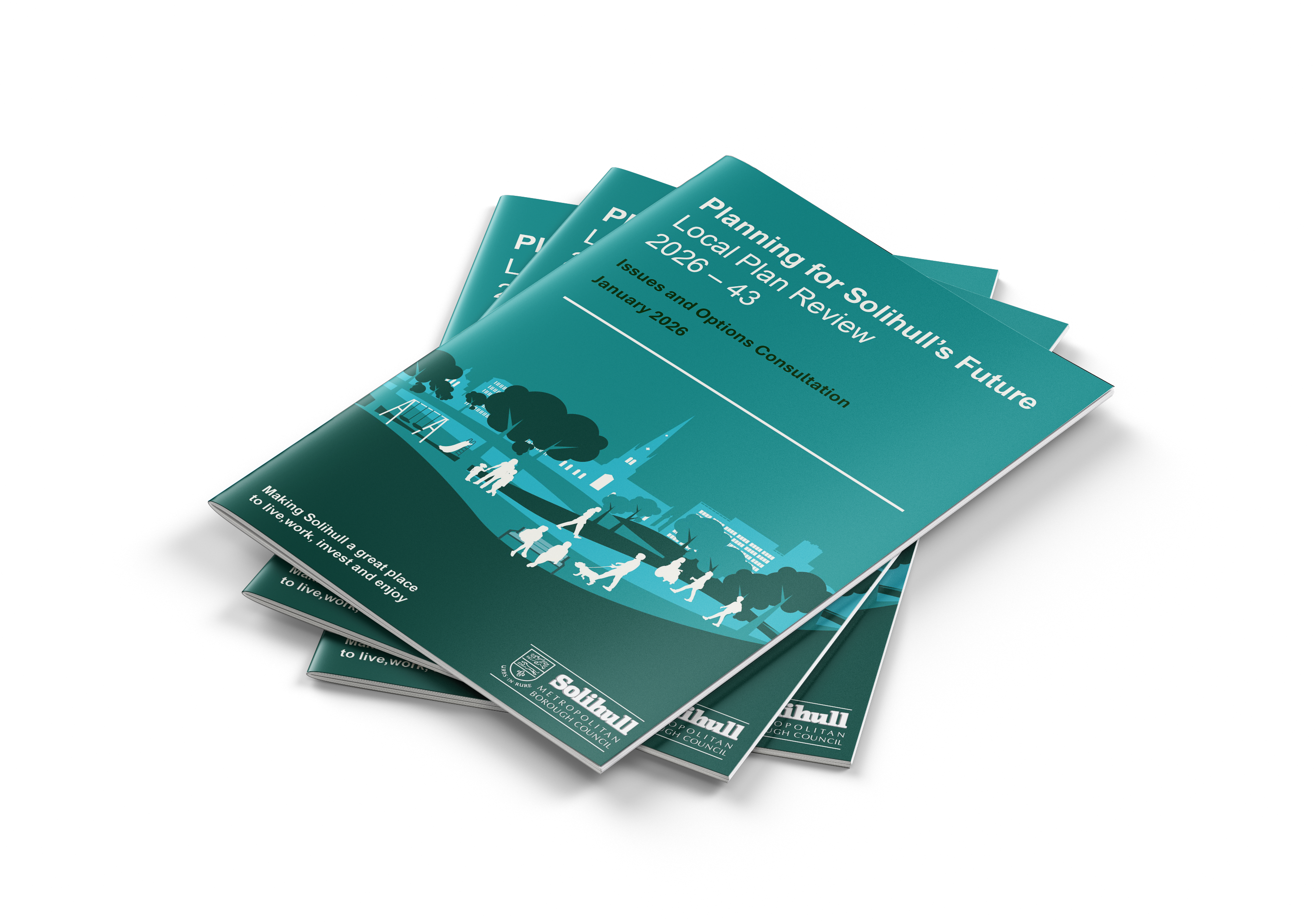
Following the Call for Sites exercise, an Issues and Options consultation was held from 30 January 2026 to the 16 March 2026. The ‘issues and options’ consultation draft Local Plan (January 2026) (the draft Local Plan) notes at paragraph 76: “Although the 2020 [draft local] plan was withdrawn, the Inspectors did consider that, in principle, the residential allocations were acceptable in principle.”

The application site has been put forward for a housing allocation, in the form of three parcels (CFS/24/296; CFS/24/287 and CFS/24/298) in the draft Local Plan and remains under consideration for housing development through the emerging plan.

While these emerging plan documents and previous assessments do not confer an allocation or planning permission, they demonstrate the continuing consideration of the site as a potential location that is suitable for housing. This is important context and supports the case that the site can contribute towards meeting Solihull’s housing requirement.

Wokingham Borough Council Draft Local Plan

The Planning Process

In due course, we will be submitting an Outline Planning Application with all matters reserved except for access for the site.

An Outline Planning permission establishes the principle of development subject to it meeting certain parameters. The detailed design will then need to adhere to these approved parameters and be subject to a separate Reserved Matters approval at a later date. Solihull Metropolitan Borough Council, as the Local Planning Authority, will therefore maintain control over any subsequent detailed design Reserved Matters applications.

Our Outline Planning application will seek to agree the following parameters:

  • Maximum extent of developable footprint/no build zones
  • Maximum heights of buildings
  • Landscape and open space strategy
  • Density

The Reserved Matters application will cover the following elements in full detail.

Final Design

  • Site Layout
  • Massing
  • Appearance and materiality
  • Boundary treatment e.g. fencing and lighting.

Amenity

  • Car Parking
  • Cycle parking/storage
  • Bin storage/refuse strategy
  • Landscaping and open space/play area design
  • Detailed access within the site and street road design, including lighting.
  • Design of Pedestrian and cycle routes.
model of a construction of a house

Emerging Proposals

Our vision for the site is to create a high-quality, landscape-led, sustainable residential development that respects and integrates with the site’s surroundings.

The proposals aim to deliver a vibrant, welcoming community that feels like a natural extension of Knowle, offering a diverse mix of up to 150 new homes, including up to 40% affordable housing, set within green spaces and supported by strong connections to local amenities.

In due course, an outline planning application will be submitted. This will establish the overall principles of development, including how the site is arranged and the distribution of built and green spaces. Detailed matters such as the design of homes, layout and landscaping will be considered at a later stage through a Reserved Matters application.

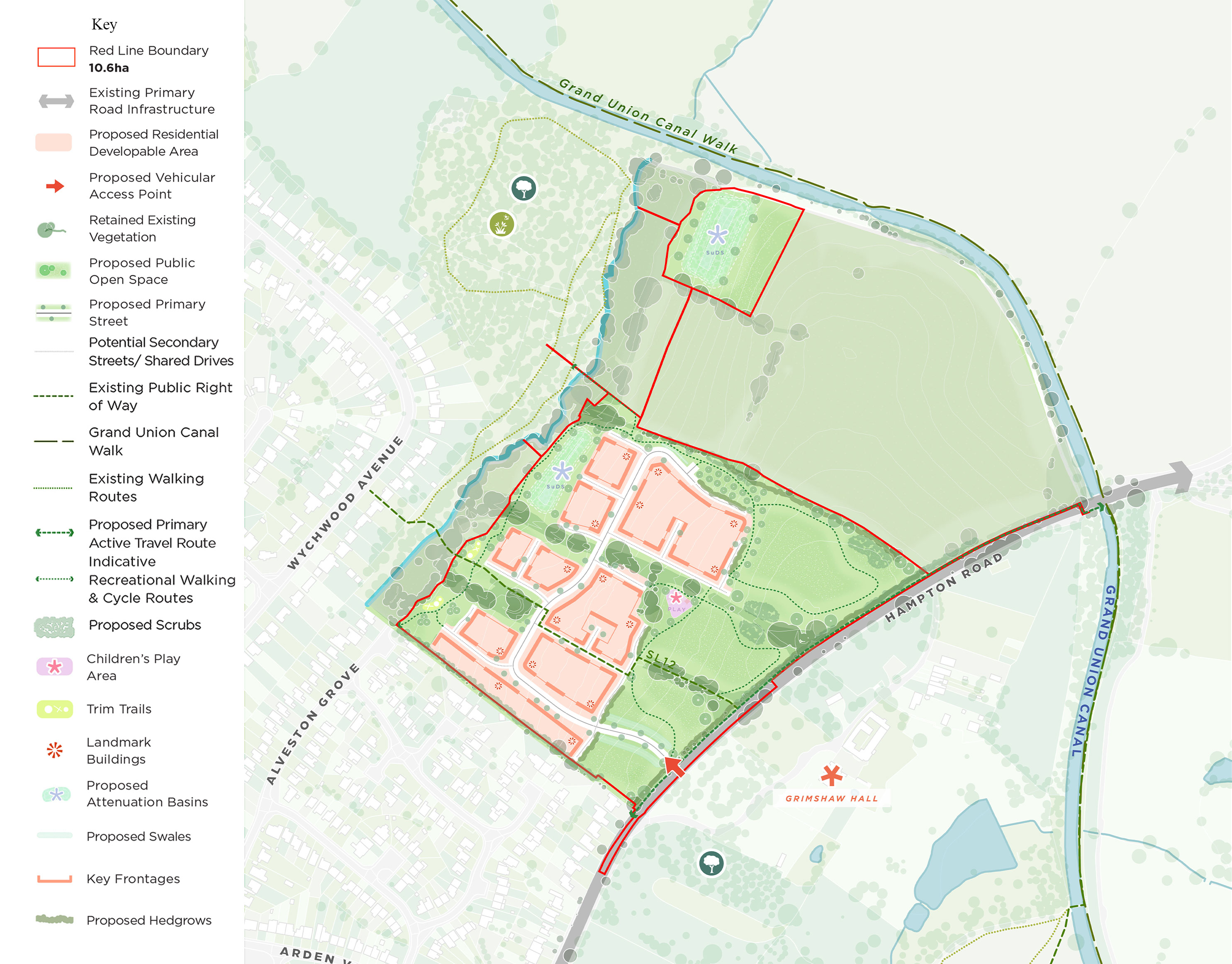
Our emerging masterplan
Emerging masterplan (Click to Enlarge)

Key features:

  • Up to 150 new energy-efficient homes with low-carbon heating, offering a range of house types, tenures and sizes.
  • Up to 40% affordable housing, helping to meet local needs and in compliance with SMBC policy.
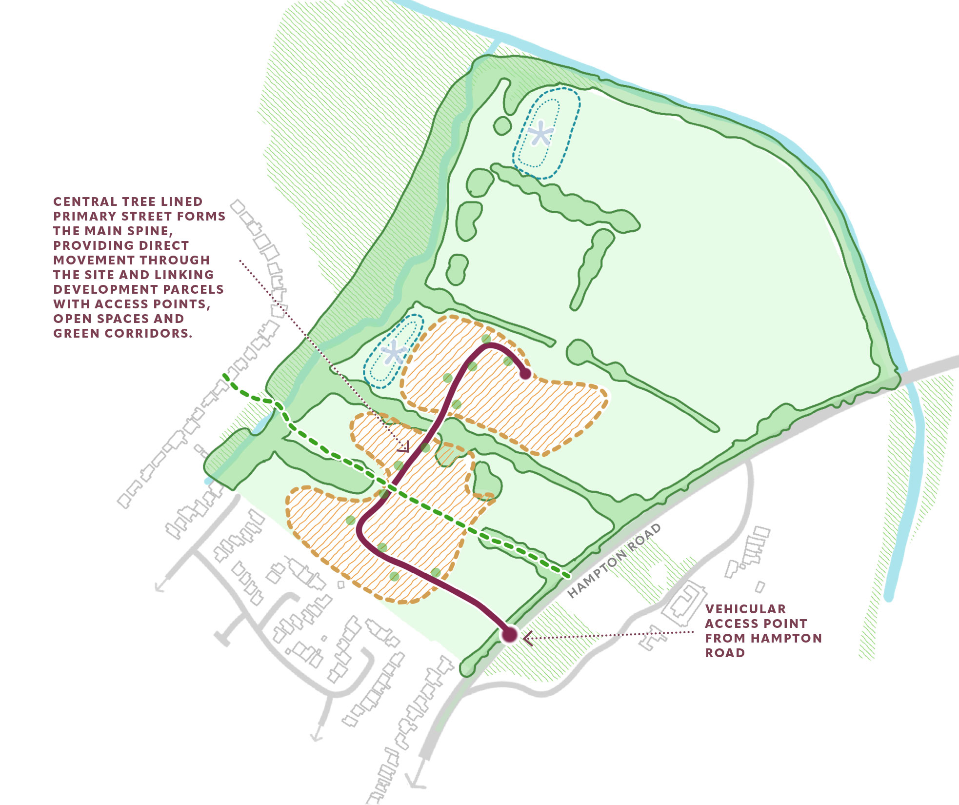
  • One vehicle access point from Hampton Road.
  • Improved access to the Public Right of Way (PRoW) network.
  • Development areas set back from Hampton Road creating a sensitive heritage buffer with Grimshaw Hall.
  • Building layout responding to the Site's natural topography and landscape features.
  • Buildings are predominantly 2 storeys with up to 2.5 storeys at local landmarks. Building heights will be limited to 2 storeys along the eastern development edges to reduce potential visual impacts on the heritage buffer with Grimshaw Hall.
  • A hierarchy of streets and lanes enhancing legibility.
  • Pedestrian and cycle links throughout the site and connections into the immediate surrounding area.
  • Street trees to be planted wherever possible.
  • Provision of multi-functional public open space, natural play and recreational routes - accessible by existing and new residents.
  • Safe and easy access to children's play spaces.
  • Naturalised Sustainable Drainage Systems (SuDS) features that integrate water management with habitat diversity and visual interest.
  • A minimum of 10% Biodiversity Net Gain (BNG).
  • Retention of all significant existing trees and hedgerows, where possible to respect the setting of listed Grimshaw Hall.
  • Car parking spaces, including reduced mobility and visitor parking spaces - compliant with Solihull Supplementary Planning Document Vehicle Parking Standards and Green Travel Plans (2006) – full details at reserved matters stage.
  • EV charging points for every home.

Landscape and Ecology

The proposals have been shaped by a landscape-led approach, using the existing vegetation, field boundaries and the wider countryside setting to define the new neighbourhood's structure. The aim is to create a development that sits comfortably on the edge of Knowle while providing attractive, accessible green spaces for current and future residents.

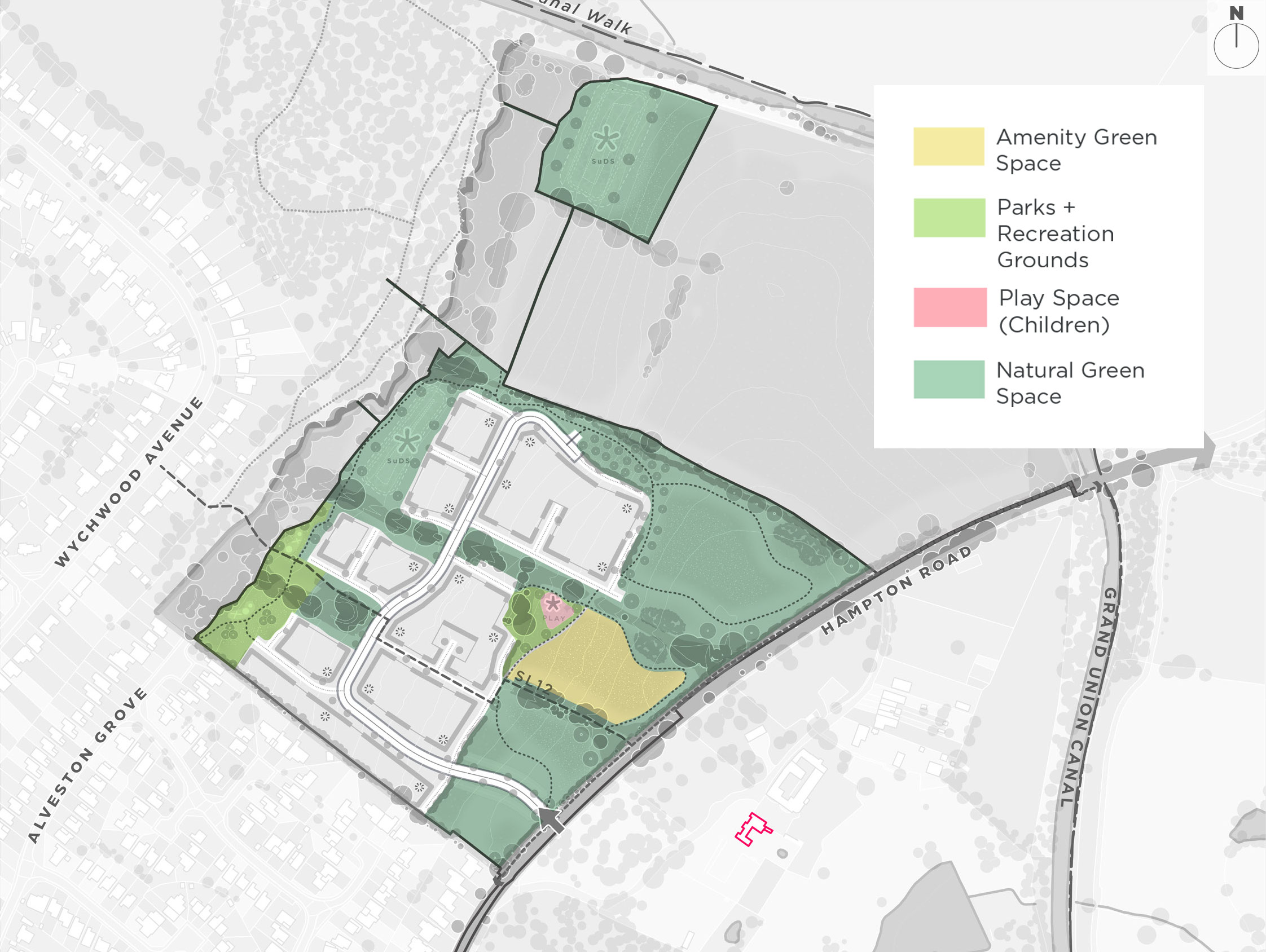
Approximately 60% of the site, around 6.35 hectares, is identified as green space in the current framework masterplan. This includes public open space, ecological areas, Sustainable Drainage Systems (SuDS), walking and cycling routes, and other green infrastructure.

The landscape proposals build on the mature trees, hedgerows and woodland vegetation already present around and across the site. These features provide an established landscape framework and will be retained wherever practicable, with new native planting used to strengthen connections between them and to establish a well-vegetated edge to the new development. This reflects the wooded and hedgerow character of the wider Arden landscape around Knowle. The local Landscape Character Assessment identifies mature hedgerow trees, wooded watercourses and a strong hedgerow structure as characteristic features of the Knowle and Dorridge Fringe.

The green infrastructure network is also intended to support biodiversity throughout the development. New tree, scrub, hedgerow, meadow and wetland habitats will complement retained vegetation and strengthen habitat connections across the site. Sustainable drainage areas can form part of this network, integrating water management with ecological and amenity functions.

The development will deliver a minimum 10% Biodiversity Net Gain, with opportunities to increase biodiversity value through habitat creation and enhancement integrated into the detailed landscape and ecological design. The intention is that new development is accompanied by a stronger and more varied network of habitats, while also giving residents greater opportunities to experience nature as part of everyday life.

To support health and wellbeing, the landscape has been designed to offer more than just grassy areas around the development. A network of paths, open spaces, naturalistic planting, play and informal recreation will encourage people to walk, spend time outdoors and interact with the landscape. The result is intended to be a green neighbourhood in which the landscape forms part of the day-to-day experience.

Landscape Concept Plan
Landscape Plan (click to enlarge)

The landscape strategy includes:

Green Infrastructure

Green Infrastructure

Extensive new green space, providing opportunities for informal recreation, walking, play and everyday contact with nature, all close to people’s homes.

Native planting

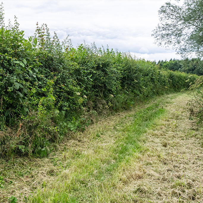
Native planting

Retention and enhancement of existing trees and hedgerows, using these features as the foundation of the landscape framework and reinforcing them with locally appropriate native planting.

A substantial eastern green corrido

Connectivity

A substantial eastern green corridor, creating a landscaped transition between new homes and Hampton Road, and providing space for habitat creation, recreation, and tree planting.

Open countryside

Open countryside

A well-defined northern settlement edge, with native trees, hedgerows and scrub planting helping the new neighbourhood transition into the open countryside.

Existing vegetation

Existing vegetation

Protection and reinforcement of the landscape adjoining Purnell’s Brook, retaining existing vegetation within the site and strengthening the wooded character along the western edge.

Green Character

Green Character

A sensitive response to Hampton Road and Grimshaw Hall, with development set back from the road and existing and proposed vegetation helping to retain its green character and maintain landscape separation from the Grade I listed Hall.

Local landscape

Local landscape

New native tree, hedgerow and scrub planting, including characteristic species such as oak where appropriate, helping reinforce local landscape character while creating new habitat.

Seasonal landscape

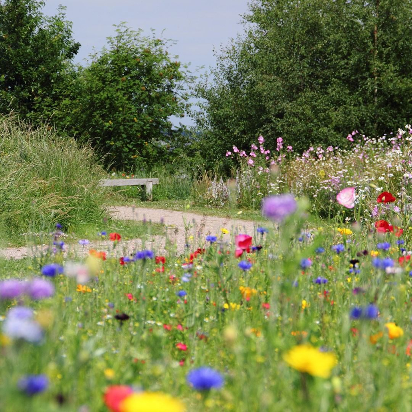
Seasonal landscape

Wildflower and species-rich grassland, providing more varied habitats than conventional amenity grassland and creating attractive seasonal landscapes for residents and visitors.

Naturalised SuDS

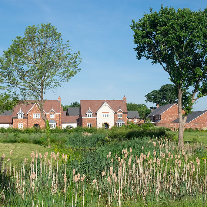
Naturalised SuDS

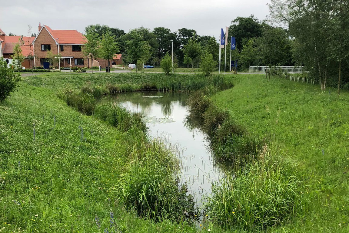
Naturalised SuDS, including attenuation areas, swales and associated marginal planting. These areas will help manage surface water while contributing to habitat diversity and visual interest.

Recreational routes

Recreational routes

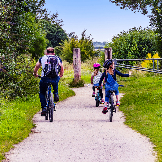
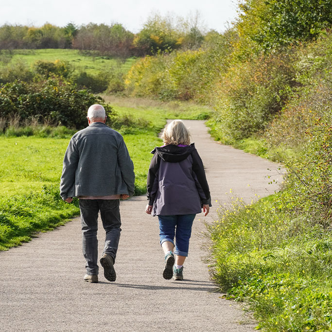
Connected walking and cycling routes linking homes with open spaces and the existing Public Right of Way, creating opportunities for circular recreational routes through the site, including mown paths that cut through wildflower grassland.

Active recreation

Active recreation

Opportunities for active recreation, including informal fitness and trim-trail elements within the wider green network, encouraging walking, exercise, and outdoor activity.

Children's Play Spaces

Children's Play Spaces

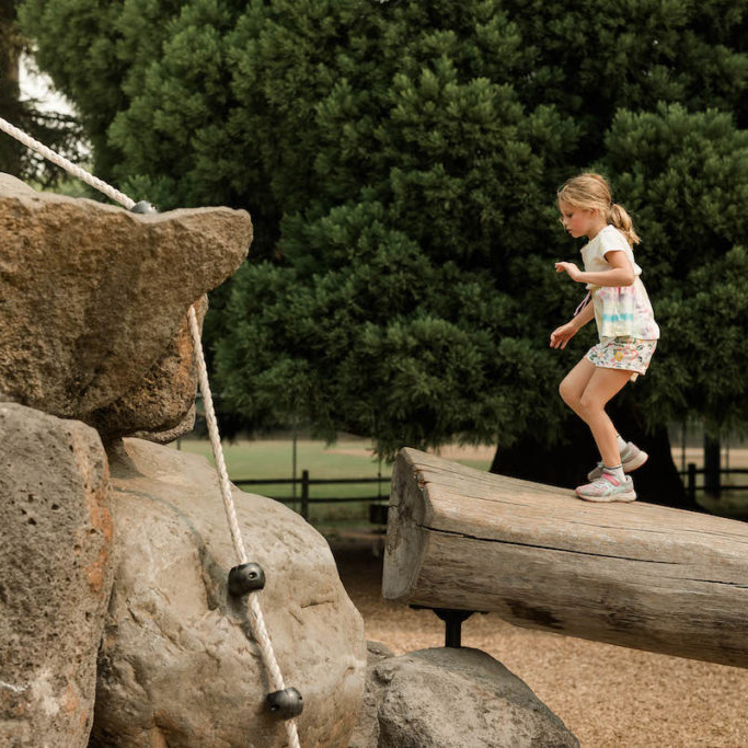
Play integrated within the landscape, providing accessible opportunities for children to play within the wider open-space network, including naturalistic and equipped play where appropriate.

Access, Movement and Transport

A focus on walkability and active travel will be achieved through safe, pedestrian-friendly streets, dedicated footpath and cycle links, and enhanced access on Hampton Road - promoting low-carbon lifestyles and a strong sense of place.

Access

Vehicle Access: The vehicle access to the site will be provided via a new priority T-junction on Hampton Road, positioned to serve the development efficiently and designed in accordance with current standards. This junction will accommodate all routine residential traffic as well as refuge and emergency vehicles and provide a clear, legible gateway into the site.

Cycle and Pedestrian Access: The proposed access junction incorporates 2m footway provision, which will connect with the existing footway provision immediately south-west of the access, providing connections to amenities and facilities in Knowle village centre, while also providing the most direct route from the site towards the closest bus stops on Warwick Road and Dorridge railway station.

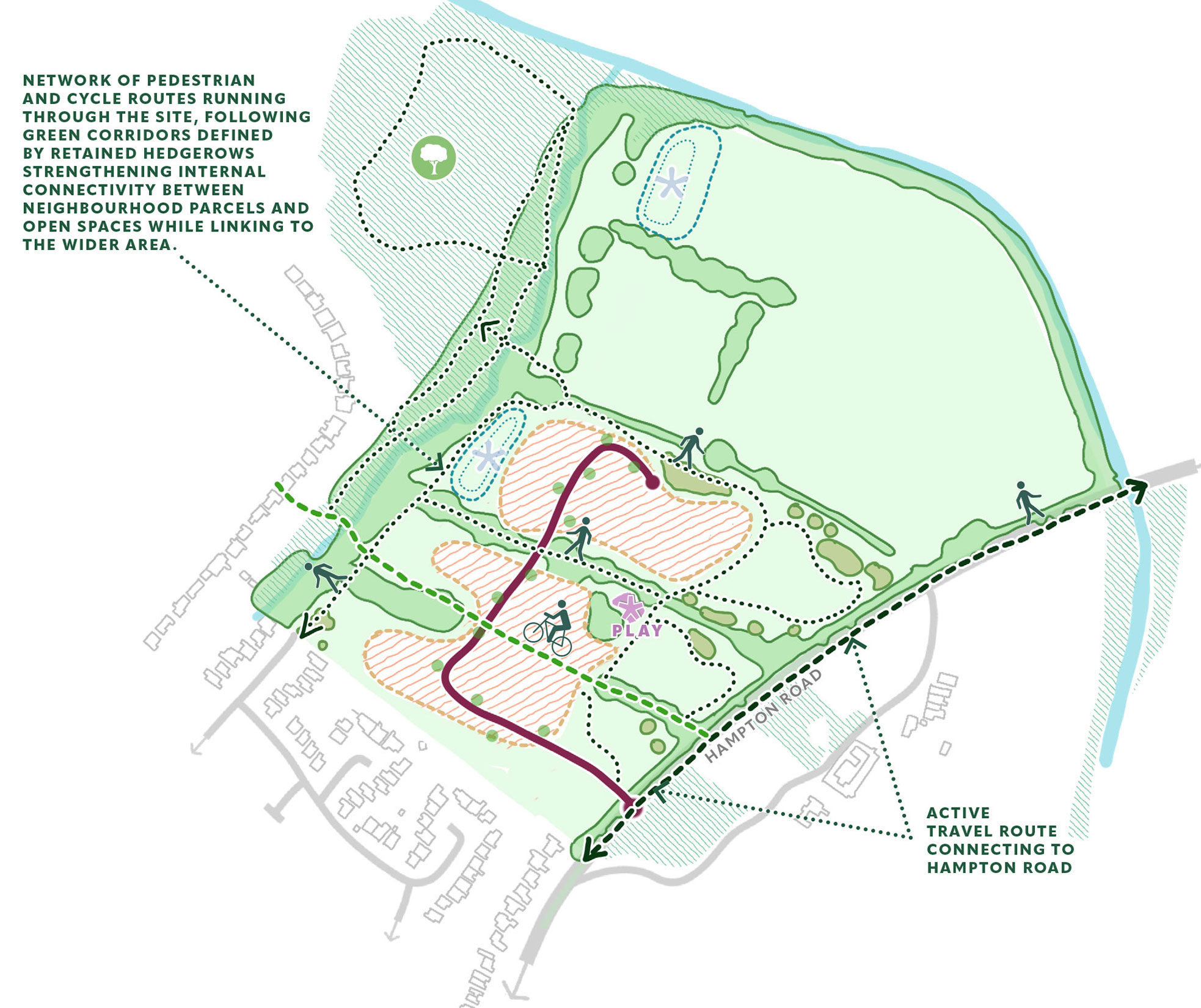
A dedicated pedestrian route is proposed to the north-east of the proposed access junction, along the site frontage with Hampton Road, providing a clear and accessible connection along this key frontage, and onward connections to the canal towpath to the north. The design has been developed with careful consideration for the setting of Grimshaw Hall and the rural character of Hampton Road.

In addition, a network of walking and cycling routes will run throughout the site, following green corridors and retained hedgerows. These routes will link different parts of the development, including open spaces and play areas, while also connecting to the canal towpath to the north and Knowle village centre to the south. Together, this network is intended to create safe, convenient and well-connected routes for both everyday journeys and leisure use. These routes will be detailed as part of a future Reserved Matters application.

Public Right of Way SL12, including the footbridge over Purnell’s Brook, will be enhanced through sensitive landscaping and paving designed to protect tree Root Protection Areas. Where appropriate, this route will be carefully integrated into the proposed housing areas and street network.

Parking Provision: The exact parking quantum will be determined as part of future Reserved Matters applications, but each home will have access to car parking spaces and/or garages, and EV charging will also be made available. The number of car parking spaces including reduced mobility and visitor spaces will be in compliance with Solihull’s Vehicle Parking Standards and Green Travel Plans (2006) Supplementary Planning Document (SPD). Cycle parking will also be provided in line with the adopted standards, with adequate parking provided for both residents and visitors.

Hoover over image and click the arrows to scroll through the images:

  • Access Plan

    Access Plan (click to enlarge)

  • Pedestrian and Cycle Routes

    Pedestrian and cycle routes plan (click to enlarge)

Movement and Transport

Walking

The southern edge of the site benefits from continuous footways along Hampton Road, providing direct connections to Knowle High Street, Warwick Road, and the village centre. An informal path along the eastern side of Hampton Road highlights a well-established pedestrian desire line towards the Grand Union Canal towpath, demonstrating existing movement patterns.

Cycling

The surrounding road network offers convenient opportunities for everyday cycling, with direct routes to Knowle village centre, Dorridge, and Solihull. Sections of the nearby Grand Union Canal towpath provides wider, largely traffic-free connections, extending towards Kingswood, Birmingham, and beyond, linking into longer-distance cycle routes.

Bus / Local Transport

Regular bus services operate on the main bus corridor through the village; along Warwick Road. These stops are served by the A7, A8 and 87, providing connections to Dorridge, Solihull and Coventry. Bus stops are located within approximately 750 metres of the site entrance, ensuring convenient access within walking distance. These services provide a practical and sustainable alternative to private car travel.

Rail

The nearest railway stations to the site are Dorridge, Widney Manor and Solihull. Dorridge and Solihull stations are both on the Chiltern main line and provide direct services to Birmingham, London, Stratford-upon-Avon and Worcester. The services routing to/from Solihull Station run more frequently than those routing to/from Dorridge Station.

Dorridge Station is approximately 11 minutes cycle, 26 minutes bus journey (including walking to and from bus stops) and 45 minutes’ walk from the site. Solihull station is approximately a 24 minute cycle and a 36 minute bus journey (including walking to and from bus stops) from the site.

Strategic Plan
Strategic Plan (click to enlarge)

Local Services and Amenities

The site lies within easy reach of Knowle High Street and the wider Solihull area with good access to local and wider amenities, including education, community facilities, services, and public transport.

Education and Community Facilities

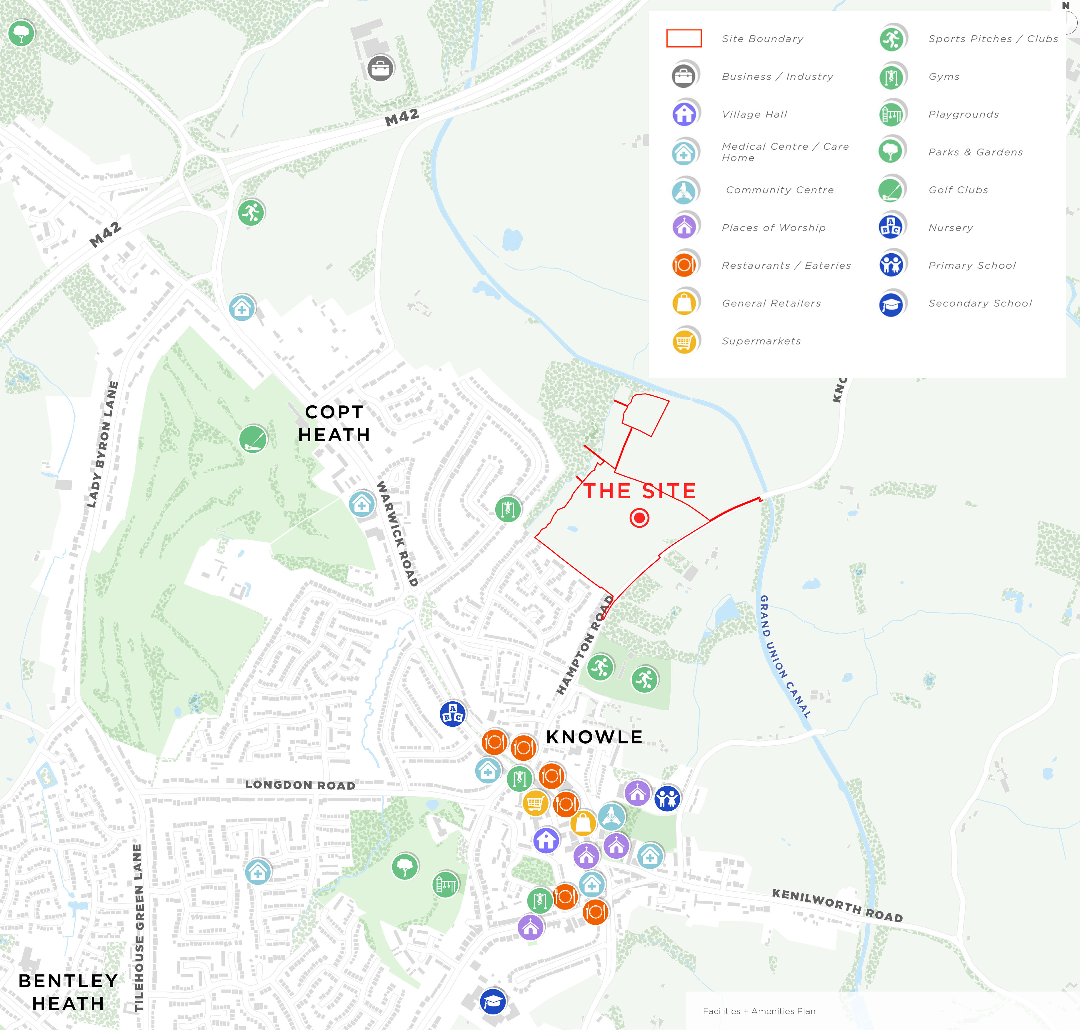
The site is within walking distance of Knowle Church of England Primary Academy (approx. 500m) and Arden Academy (approx. 1.2km), providing convenient access to primary and secondary education. Nearby community facilities include Knowle Village Hall and Knowle Library in the village centre.

Local Services and Amenities

Knowle village centre offers day to day shopping and services including a supermarket, a pharmacy, cafés, restaurants and a range of independent shops. Primary healthcare is available at GPS Healthcare – Knowle Surgery within walking distance. Public transport is close by with local bus routes on Warwick Road and rail connections Dorridge (approx. 3km) provide sustainable links to Solihull and Birmingham.

Open Space and Recreation

From the centre, Knowle Park is easily accessible on foot with play facilities, tennis courts, pond, nature areas and a network of accessible paths. The Grand Union Canal towpath is accessible just north of Hampton Road providing an attractive green corridor for walking and wider recreational connections along the canal network.

Facilities and Amenities Plan
Facilities and Amenities Plan (click to enlarge)

Heritage

Grimshaw Hall and its setting

Grimshaw Hall is a Grade I listed building of historic and architectural importance. Careful consideration has been given throughout the design process to ensure that its setting and significance are respected.

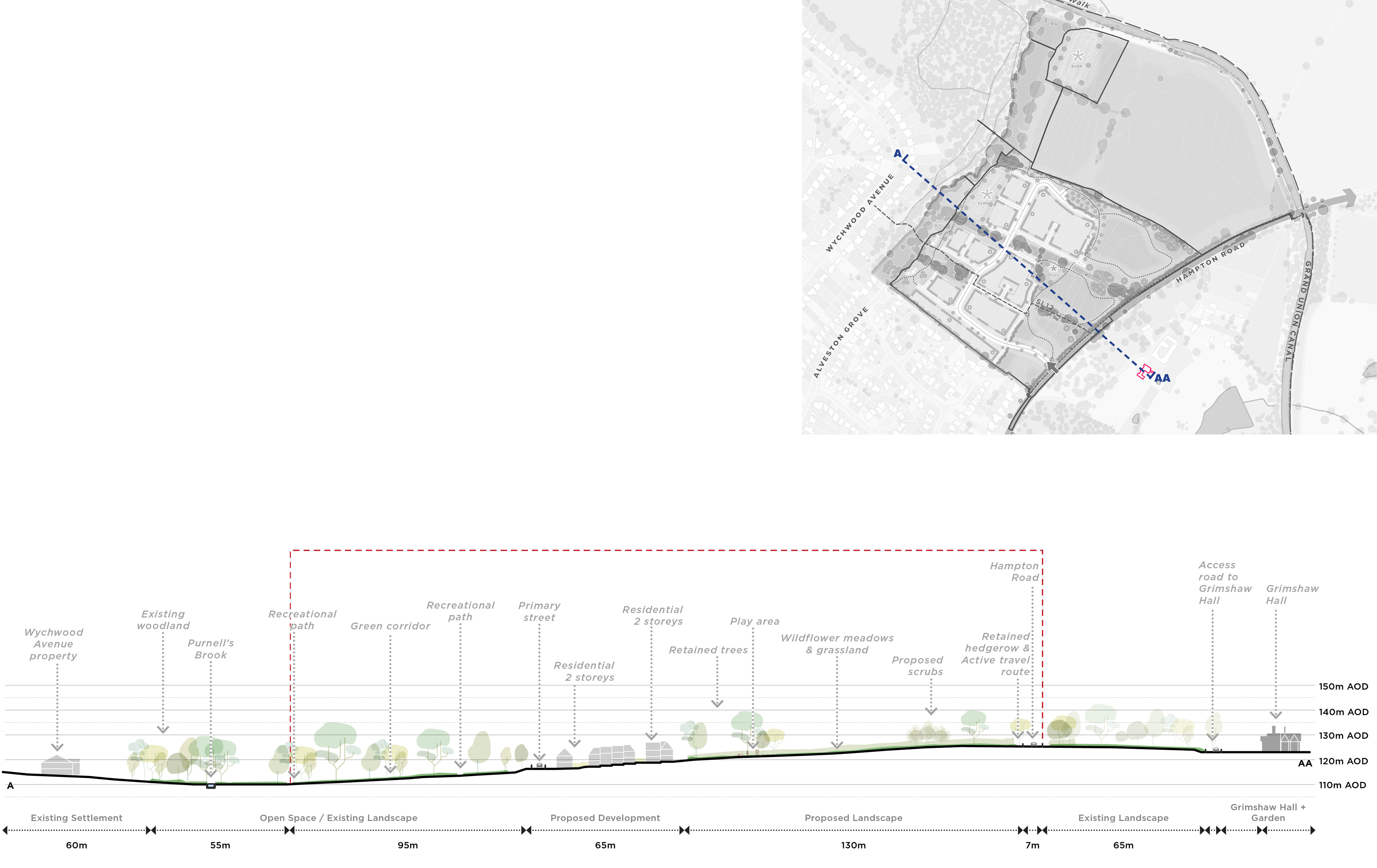
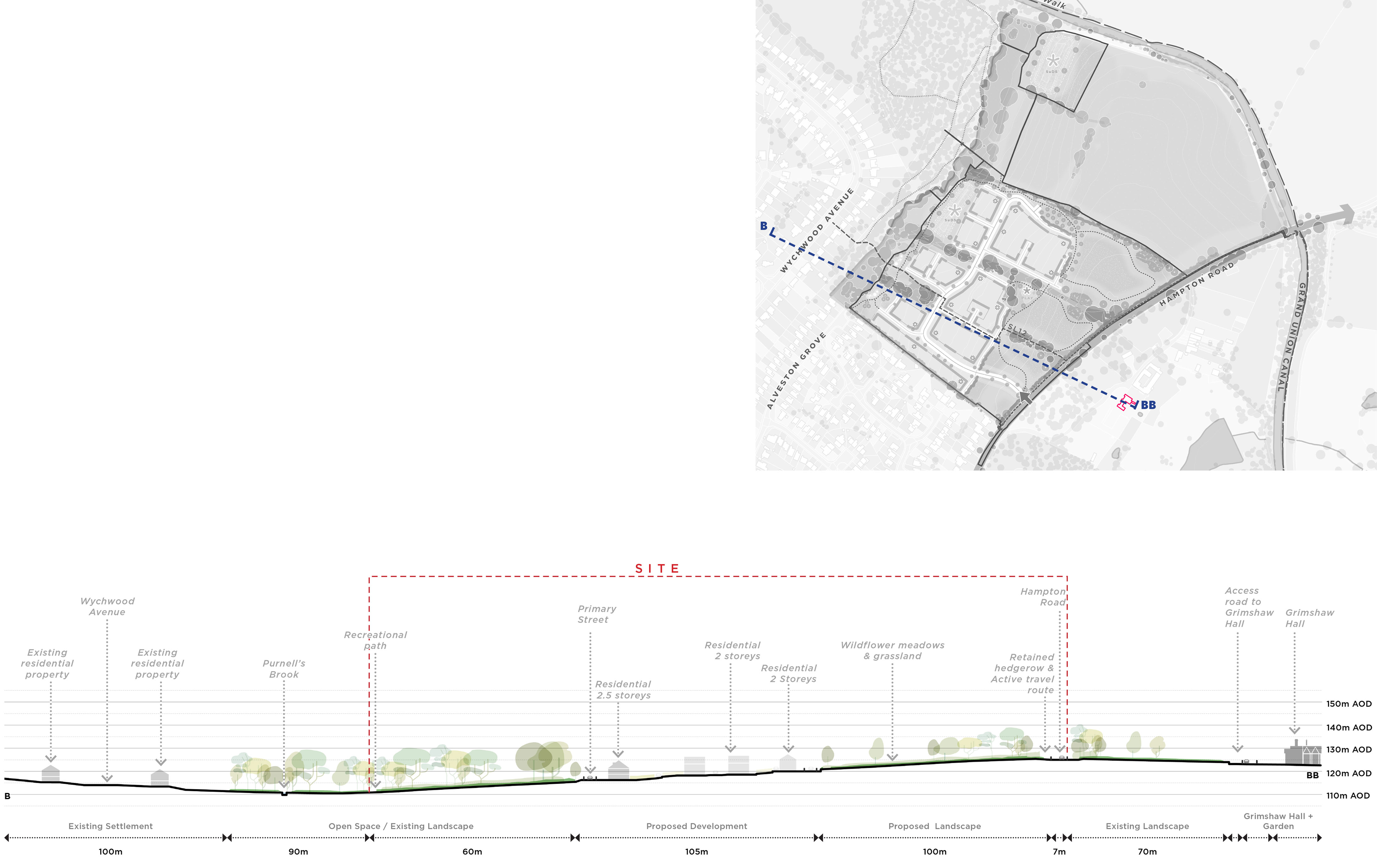
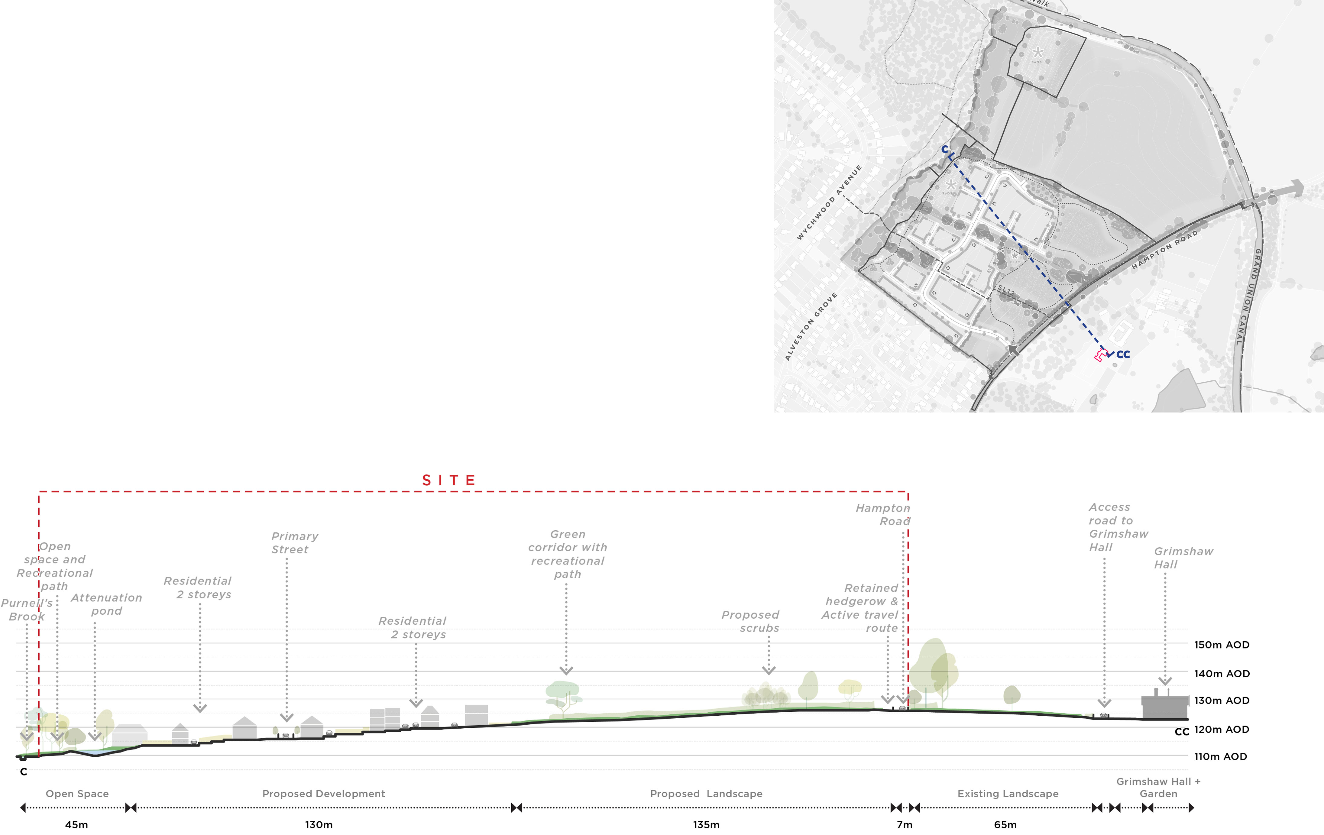
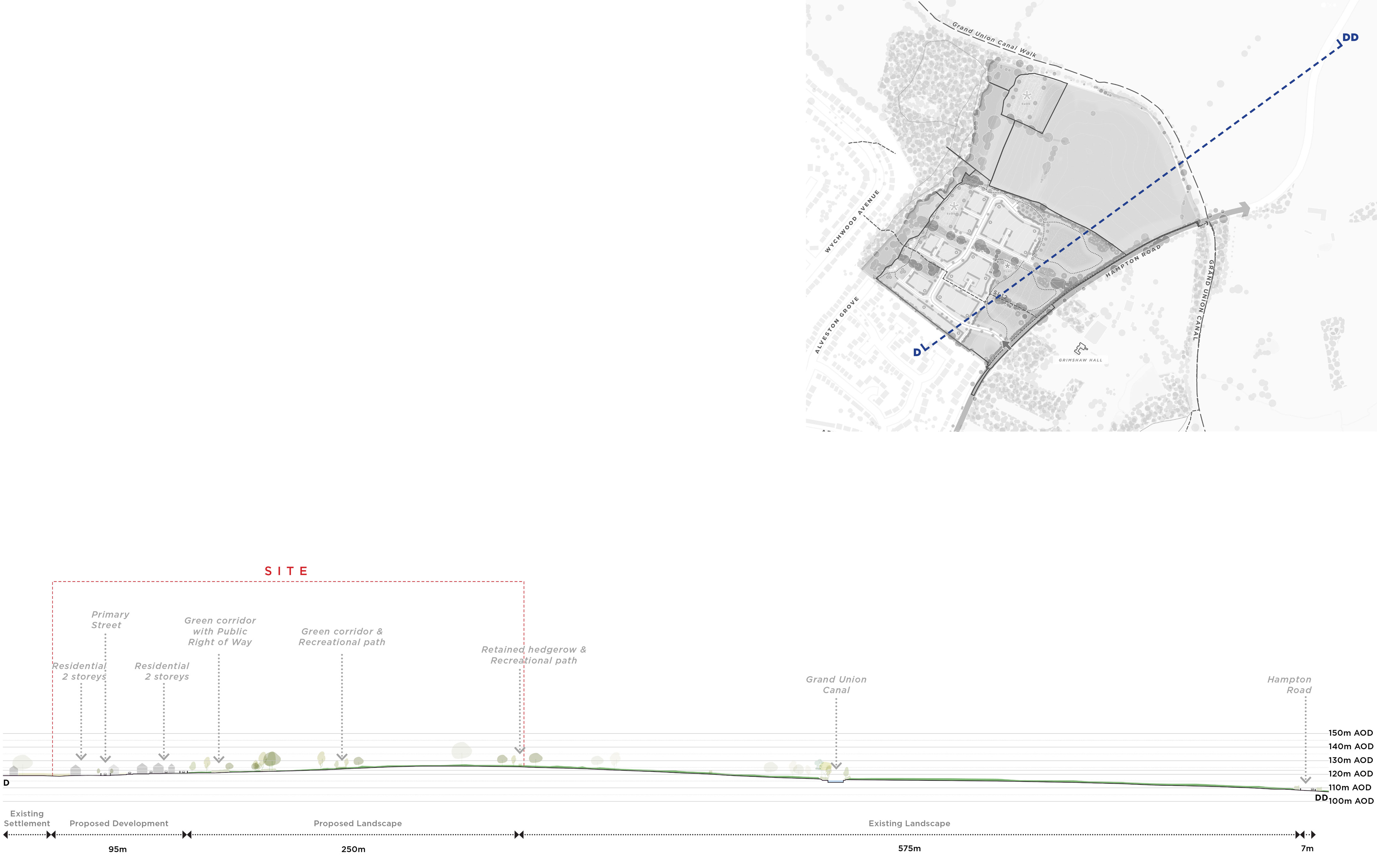
The proposed development site is well separated from Grimshaw Hall. Due to existing trees, hedgerows and changes in ground levels, the Hall is not generally visible from the site, nor is the site visible from the Hall. This existing sense of separation means there is limited physical, visual or experiential connection between the two.

There are no key views, approaches or routes to Grimshaw Hall across the site. The Hall’s front garden is intentionally enclosed and set apart from Hampton Road, reinforcing this separation. The access point has been positioned away from Grimshaw Hall to avoid visual impact and minimise light spill.

As a result, Grimshaw Hall will continue to be experienced much as it is today.

Hoover over image and click the arrows to scroll through the images:

  • Site Section-A

    Section A-AA (click to enlarge)

  • Site Section-B

    Section B-BB (click to enlarge)

  • Site Section-C

    Section C-CC (click to enlarge)

  • Site Section-D

    Section D-DD (click to enlarge)

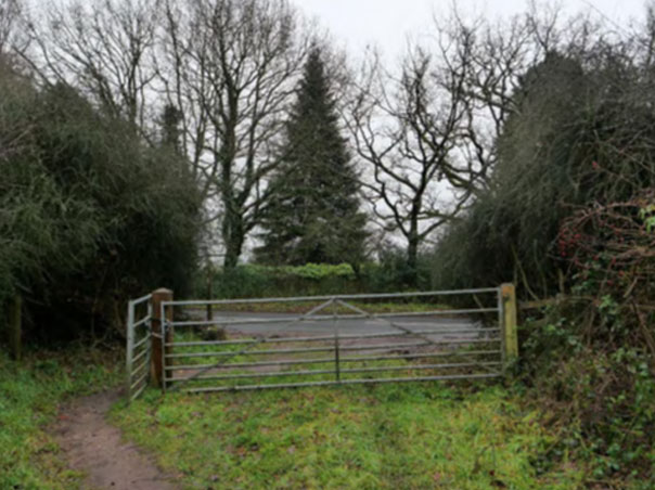
  • Closer view from the gate to the track on the application site on Hampton Road, roughly opposite Grimshaw Hall, looking towards it. Grimshaw Hall is not visible from here

    Closer view from the gate to the track on the application site on Hampton Road, roughly opposite Grimshaw Hall, looking towards it. Grimshaw Hall is not visible from here.

  • View from the application site further to the NW of Grimshaw Hall looking towards it. The coniferous tree in the centre left stands in front of Grimshaw Hall, which is not visible from here

    View from the application site further to the NW of Grimshaw Hall looking towards it. The coniferous tree in the centre left stands in front of Grimshaw Hall, which is not visible from here

  • View from the application site to the west of Grimshaw Hall, looking towards it. The coniferous tree on the centre left stands in front of Grimshaw Hall

    View from the application site to the west of Grimshaw Hall, looking towards it. The coniferous tree on the centre left stands in front of Grimshaw Hall.

  • View from the track on the application site, roughly opposite Grimshaw Hall, looking towards it. Grimshaw Hall is not visible from here

    View from the track on the application site, roughly opposite Grimshaw Hall, looking towards it. Grimshaw Hall is not visible from here.

Drainage & Flooding

Surface water drainage

A comprehensive sustainable surface water drainage strategy has been developed for the site to ensure that rainwater can be safely managed as part of the development and that the proposals do not increase flood risk elsewhere.

The strategy has been prepared in accordance with the National Sustainable Drainage Systems (SuDS) Standards, National Planning Policy Framework (NPPF) and Planning Practice Guidance (PPG), together with the drainage requirements of Solihull Metropolitan Borough Council as the Lead Local Flood Authority.

As the site is currently undeveloped greenfield land, an important principle of the strategy is that the development should not result in rainwater leaving the site any faster than it does today. Surface water runoff from the development will therefore be restricted to the equivalent greenfield runoff rate, helping to ensure there is no increased flood risk downstream.

Detailed ground testing has also been undertaken to understand whether rainwater could be drained naturally into the ground. This found that infiltration drainage would not be suitable due to the ground conditions and groundwater levels in parts of the site.

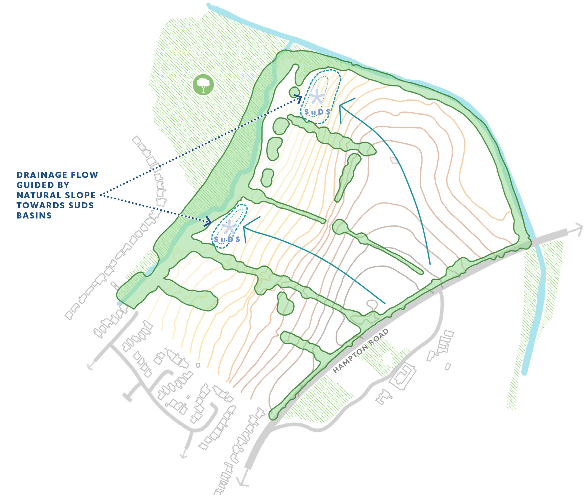
Instead, rainwater from roofs, roads and other hard surfaces will be collected through a drainage network and directed to two landscaped attenuation basins, positioned at natural low points within the site. These will temporarily store water during periods of heavy rainfall before releasing it slowly and at a controlled rate into Purnell’s Brook.

Importantly, the drainage system has been designed to accommodate an extreme 1 in 100-year rainfall event, together with an additional 40% allowance for the future effects of climate change.

The strategy will incorporate a range of Sustainable Drainage Systems (SuDS), including attenuation basins, permeable paving, swales and other planted drainage features where appropriate.

These features do more than simply manage rainwater. They can also help to improve water quality, create new habitats and support biodiversity, while forming an attractive and integrated part of the landscape and open spaces within the development.

Overall, the drainage strategy provides a sustainable and carefully controlled approach to managing surface water, designed around the specific characteristics of the site and in accordance with national and local requirements.

Foul Water Drainage

Wastewater from the new homes will be discharged to the existing Severn Trent Water public foul sewer network.

As part of the drainage assessment, an enquiry has been made to Severn Trent Water, which has confirmed that there is a suitable connection point close to the site and that the existing network has sufficient capacity to accommodate the anticipated wastewater flows from the development.

The new foul drainage network will be designed to operate primarily by gravity, allowing wastewater to flow naturally to the existing sewer network wherever possible. This will be designed in accordance with Severn Trent Water's requirements and relevant drainage standards.

As the proposals progress, further detailed design work will confirm the precise sewer levels, routes and connection arrangements. If it is found that part of the development cannot be served by gravity drainage, an appropriately designed pumping solution would be considered.

The final drainage arrangements will therefore be developed in consultation with Severn Trent Water, ensuring that wastewater from the development can be managed safely and effectively.

Flood Risk

A detailed Flood Risk Assessment has been undertaken to understand the potential sources of flooding affecting the site and to ensure that the development can be delivered safely without increasing flood risk elsewhere.

The vast majority of the site lies within Flood Zone 1, which is defined as land with the lowest probability of river flooding. A small area alongside Purnell's Brook is affected by higher flood risk, but the development has been carefully designed so that all new homes are located outside Flood Zones 2 and 3.

Detailed flood modelling of Purnell's Brook has been undertaken to understand how the watercourse could behave during periods of significant flooding. This assessment has also considered the future effects of climate change and the potential impact of culverts becoming blocked.

The modelling confirms that the proposed residential development can be accommodated safely, with all built development located outside the modelled flood areas.

Potential surface water flooding has also been assessed. The majority of the site is at very low risk of surface water flooding, and existing routes through which water naturally flows across the site will be retained within landscaped green corridors. This will help ensure that water can continue to move safely through the site during periods of particularly heavy rainfall.

The development has also been designed to remain safe throughout its lifetime, taking account of the future effects of climate change. Finished floor levels for the new homes will be set at appropriate levels, while rainwater from the development will be managed through the proposed sustainable drainage system before being released at a controlled rate into Purnell's Brook. Taken together, the Flood Risk Assessment, detailed modelling and proposed drainage measures demonstrate that the development can be delivered safely and without increasing flood risk elsewhere, in accordance with national and local planning requirements.

Topography and Drainage Plan
Topography and Drainage Plan (click to enlarge)
  • Drainage image
  • Suds

Sustainability

Our high sustainability standards ensure that the new homes and spaces we build today are fit for the future. The proposed development of up to 150 residential dwellings has been designed to meet and exceed the requirements of Building Regulations and planning policy.

We will aim to achieve this through:

  • A fabric first approach for new homes that uses high-performance and efficient building materials to reduce energy consumption and costs for new residents
  • Building water and energy-efficient homes that include low and zero carbon technology e.g. solar panels
  • Provision of waste and recycling storage
  • Inclusion of secure cycle storage and cycle routes, to encourage alternative modes of travel
  • Responsible sourcing of materials
  • Minimising surface water run-off and provision of Sustainable Drainage Systems (SuDS)
  • Management of waste sustainably and efficiently during construction
  • Biodiversity enhancements to achieve 10% Biodiversity Net Gain (BNG) through new planting and habitat enhancement throughout the site.
Images of car charging, cycle storage, solar panels and a bee visiting flowers

Q&A

We recognise that proposals like this naturally prompt questions from the community. Throughout the consultation, we will keep this section updated with your questions and our responses to ensure you stay informed.

The consultation masterplan showed a proposed active travel route extending towards Alveston Grove, and we recognise the concerns raised by residents about the potential for a connection and the resulting increase in pedestrian activity.

Following the public consultation and further review by the transport team, it is not proposed that there will be a pedestrian or cycle connection from the development onto Alveston Grove. Appropriate walking and cycling connections can instead be provided via Hampton Road and the existing Public Right of Way, which will be retained and improved.

In planning and urban design, “landmark buildings” usually means buildings that are designed to be particularly distinctive or prominent, helping people recognise a place and find their way around a development.

They might be used at a key entrance, important junction, prominent corner or focal point. A landmark building does not necessarily mean a very tall or dramatic building. It can simply be differentiated through its architecture, height, materials, roofline, detailing or positioning.

Two-and-a-half storeys generally means two full floors with additional accommodation within the roof space. Typically, a 2.5-storey home would be around 9–11 metres to the ridge, although the exact height would depend on the detailed design and roof form.

The aim is to retain and strengthen the most important existing habitats and provide new habitat areas and connections through the site. Ecology work considers how species use the wider area, not simply whether individual animals are present on a particular day. The planning application will set out the proposed ecological mitigation, habitat creation and management arrangements, including how Biodiversity Net Gain will be secured and monitored over the required period.

The land comprising the existing football and cricket grounds, to the south of Hampton Road, does not form part of Bloor Homes’ current proposals and is not within the proposed development site.

The future use of that land is a matter for the landowner. Bloor Homes is focused solely on the land included within its current proposals and cannot comment on any future intentions the landowner may have for the football and cricket ground land.

The site south of Hampton Road is a separate draft allocation in the emerging local plan (reference KN1B) for 58 dwellings. However, it requires existing sports provision and football pitches to be relocated before any redevelopment can take place.

We recognise the concerns raised about existing infrastructure within Knowle. A development of up to 150 homes cannot be expected to resolve all of the village’s existing infrastructure issues, but it will be required to address the additional demands arising from the development.

As part of the planning application, the potential impacts on matters such as highways, education, healthcare, drainage and other local infrastructure are being assessed. Solihull Metropolitan Borough Council and the relevant service providers will consider that evidence and determine what mitigation or financial contributions are required as part of the development.

The proposals themselves will also deliver benefits including around 60% of the site as green space and green infrastructure, together with new and improved walking and cycling connections which will link into the existing network and help improve connectivity between the site and the wider village.

Any necessary infrastructure improvements and financial contributions would be secured through the planning process by the S106 legal agreement and the Community Infrastructure Levy. The council's Infrastructure Funding Statement will inform decisions on how the contributions will be spent. The council will also update their Infrastructure Delivery Plan (IDP) which sets out strategically how the council's necessary infrastructure will be improved (where required) in line with development, inclusive of healthcare and education. The IDP will be informed by draft site allocations and 'commitments' (i.e. approved residential planning applications). The council is required to update its IDP in line with the draft local plan, therefore the council should publish the IDP in the next local plan consultation (October/November 2026), where it will be possible to provide comments.

Affordable housing can include different types of homes, including Social Rent and other affordable rented homes, as well as affordable home ownership options such as shared ownership, discounted market sale homes and any potential future Government initiatives.

At this stage, the exact split between rented and affordable home ownership has not yet been determined. The final tenure mix would be discussed and agreed with Solihull Metropolitan Borough Council through the planning process, taking account of local housing needs and relevant planning policy. Where affordable home ownership is provided, the eligibility criteria, including whether any local connection requirements apply, would also be determined through the appropriate arrangements with the Council.

Affordable homes are homes provided for people who may not be able to afford to rent or buy a suitable home on the open market. They can include homes for affordable rent as well as homes that help people get onto the property ladder, such as shared ownership. When we say that 40% of the homes will be affordable, this means that 40% of all the homes proposed would be provided as affordable housing.

For example, if 150 homes were built, 60 would be affordable homes and 90 would be market homes. Affordable housing can be provided in a number of different ways, including Social Rent, other affordable rented homes, discounted market sale homes and shared ownership. The exact mix of affordable homes would be agreed with Solihull Metropolitan Borough Council through the planning process and secured as part of the planning permission.

We are not proposing covenants limiting each home to one vehicle. Parking provision would be designed in accordance with the relevant standards and agreed through the planning process. The aim of providing good walking and cycling connections is to give residents realistic alternatives for shorter journeys; it would not prevent people from owning or using a car.

The ecological surveys will form part of the technical evidence supporting the planning application. Once the application has been submitted and validated, the relevant reports would normally be available to view on Solihull Metropolitan Borough Council’s online planning register.

Severn Trent has formally confirmed in response to a Development Enquiry Request that there is sufficient capacity within the existing network to serve the proposed development. The supporting drainage and utilities information, including the evidence relating to capacity, will form part of the planning application submission and will be publicly available through Solihull Metropolitan Borough Council's planning portal once the application has been validated.

Grimshaw Hall is not the only heritage consideration. It is a particularly important consideration because it is a Grade I listed building close to the site, but the heritage assessment also considers the wider historic environment and the character and identity of Knowle. The planning application will include a Heritage Assessment setting out the potential effects of the proposals and the measures incorporated into the design in response.

Sustainability considerations extend beyond the management of construction waste. The detailed sustainability and construction strategies will consider matters such as energy use, building standards, materials, transport and construction activity. Contractors and suppliers would also be expected to operate in accordance with the environmental requirements and standards that apply to the development. More detailed information will be provided at a more detailed stage, prior to commencement of development, and secured via a Construction and Environmental Management Plan.

The intention is for the development to be all-electric. The detailed energy strategy, including the use of technologies such as air-source heat pumps and solar panels, is still being developed and will be set out in the subsequent detailed Reserved Matters application. We therefore cannot confirm a final percentage of homes with solar panels or heat pumps at this stage.

The ecological surveys and supporting ecology reports will form part of the technical information submitted with the planning application and will be available through the Council’s planning register once the application has been validated.

The long-term management arrangements for new habitats and green infrastructure have not yet been finalised. They would be secured through the planning process and could involve a management company or another appropriate management body. The important point is that the habitats would be subject to an agreed long-term management and monitoring regime.

The drainage and landscape strategies are being designed together and will take account of the existing behaviour of Purnell’s Brook and the surrounding nature reserve. The intention is not to remove naturally occurring wet areas that support existing habitats. Detailed flood-risk, drainage and ecological assessments will inform the final design so that flood risk is managed appropriately while recognising the ecological value of the area.

We are aware that the emerging Local Plan identifies a figure of 114 homes for the site. However, the draft pre-submission Local Plan has only just been published and will undergo formal consultation in October/November 2026. The council assessed the site capacity based on their assumptions, rather than being informed by site-specific, detailed evidence base. The appropriate number of homes will be considered through the planning application process, taking into account the characteristics and constraints of the site, technical evidence and other relevant planning considerations. The planning application inclusive of its wide range of technical work undertaken relating to all relevant planning considerations will demonstrate how up to 150 homes could be accommodated while retaining around 60% of the site as green space and green infrastructure.

No restriction is proposed on the number of vehicles residents may own. The Transport Assessment will consider the likely number and distribution of vehicle trips generated by the development and their effect on Hampton Road and the surrounding highway network. Parking would be provided in accordance with the relevant standards, alongside walking and cycling connections intended to provide alternatives for some journeys.

The Transport Assessment will consider the effect of additional traffic on the surrounding road network. Heritage impacts are assessed separately through the Heritage Assessment, which considers the significance and setting of heritage assets and the potential effects of the proposals. Where necessary, the planning process will consider whether mitigation is required.

The existing Purnell’s Brook Nature Reserve does not form part of the proposed development site, and no development is proposed within it. The Nature Reserve will therefore be retained and will not be directly impacted by the development.

Measures will also be incorporated into the proposals to ensure that the Nature Reserve and the wildlife it supports, including bats, birds and other species, are protected both during construction and in the long term. These include:

  • Measures to prevent pollution and surface water run-off from entering Purnell’s Brook during construction.
  • A sensitive lighting strategy to avoid unacceptable increases in light levels along the retained woodland and adjoining habitats, particularly for light-sensitive species such as bats.
  • Positioning homes so that rear gardens do not directly back onto the adjoining vegetation, helping to reduce the potential for garden encroachment, littering, and disturbance.
  • Providing a landscaped and vegetated buffer between the development and the existing habitats, creating a natural edge and helping to minimise potential effects.

Ecological surveys have also been undertaken to understand the habitats and species using the site and surrounding area. These will inform the mitigation, habitat enhancement and long-term management measures that accompany the planning application.

The affordable homes would be allocated or sold in accordance with the eligibility arrangements that apply to the particular tenure. Whether a specific local connection requirement would apply has not yet been determined and would be discussed with Solihull Metropolitan Borough Council as the affordable housing arrangements are agreed. We therefore would not want to suggest at this stage that every affordable home would be restricted only to people already living in Knowle.

The Transport Assessment will consider existing traffic conditions and the additional traffic generated by the development, including movements along Hampton Road and at relevant junctions. Construction traffic would be considered separately through a Construction Management Plan, which would set out measures to manage construction routes, deliveries, working hours and other potential impacts.

No, We are not saying there would be no increase in traffic. A development of up to 150 homes would generate additional vehicle movements. The purpose of the Transport Assessment is to quantify those movements, understand where they are likely to travel and assess the effect on the local highway network. That evidence will form part of the planning application and will be considered by the highway authority.

The development has been set back from Hampton Road as part of the landscape- and ecology-led approach to the site. This allows a substantial area of green infrastructure to be retained and created along the site frontage, helps respond to landscape and heritage considerations and provides separation between new development and Hampton Road. The green space shown is an integral part of the current proposals and will be secured by parameter plans as part of the outline planning application; it is not being shown as land reserved for future housing.

The current intention is for the development to be all-electric, meaning homes would not be connected to the gas network or rely on oil for their principal heating. The detailed energy strategy will be developed as the scheme progresses.

The proposed vehicle access is from Hampton Road because this is the appropriate point from which the site can be served by the public highway. Alveston Grove is not proposed as a vehicular access to the development. The design and safety of the Hampton Road junction, including visibility and traffic effects, will be assessed as part of the Transport Assessment and Road Safety Audit and considered by the highway authority.

The site is in the Green Belt. The council is proposing to allocate the site for residential development with appropriate justification provided in the draft Local Plan, noting that "The allocation constitutes a 'rounding-off' of the settlement in a logical manner by continuing the Green Belt boundary on from the rear of the properties along Wychwood Avenue, down to Hampton Road. The Site lies within a parcel identified as potential grey belt in the Council's July 2026 Green Belt Assessment".

If planning permission is granted, the development would be built in phases rather than all at once. The detailed construction programme has not yet been fixed and will be detailed at a later stage, prior to commencement, in a Construction and Environmental Management Plan. Bloor Homes' proposals relate solely to the land within the current application site, and our focus is on the proposals currently being promoted for up to 150 homes.

Any proposals for development on adjoining land in the future would be a matter for the relevant landowner and would need to be considered through a separate planning process on their own merits. Bloor Homes cannot comment on or make commitments about land outside its control.

The intention is for an all-electric development, but the detailed specification for individual homes has not yet been fixed. Air-source heat pumps and solar panels are among the technologies being considered, but it would be premature to say that every home will definitely have both until the detailed energy strategy and house designs are finalised.

The intention would be to maintain public access wherever it is safe and practicable to do so during construction. There may need to be temporary diversions or short-term restrictions at particular stages for safety reasons. Any such arrangements would be managed through the construction process and communicated in advance where required.

There is not yet a fixed construction programme. If outline planning permission is granted, further detailed approvals would still be required before construction could begin. A development of this scale would then normally be delivered in phases over a number of years rather than being built all at once. A firmer programme would be available later in the planning and detailed design process.

The detailed boundary treatments and security measures have not yet been designed. At reserved matters stage, the layout, landscaping, boundary treatments and relationship with neighbouring properties would be considered in detail and assessed as part of the Reserved Matters application by the Designing Out Crime Officer. The design would need to provide appropriate privacy, security and defensible boundaries while also integrating the development with the surrounding green infrastructure.

Yes. As part of preparing the proposals, the project team has engaged with Solihull Metropolitan Borough Council and relevant technical consultees. This is normal for a proposal of this scale and helps identify the information and assessments that will be required. Any planning application will still be subject to the Council’s formal consultation and determination process.

We have also engaged Knowle Ward Councillors to make them aware of the emerging proposals and the public consultation.

The detailed housing mix has not yet been fixed because this is an outline proposal. The eventual mix of house sizes and types, including whether there are two-bedroom detached homes, would be developed at the detailed design/reserved matters stage and would take account of local housing needs and planning policy.

We recognise concerns about pressure on local schools. The planning application will assess the likely education needs arising from the development and the Council, as education authority, will determine whether additional school capacity or a financial contribution is required in line with their Infrastructure Delivery Plan and Infrastructure Funding Statement. Any necessary mitigation would be addressed through the planning process rather than the developer independently determining school admissions or capacity.

The current proposals show a single principal vehicular access from Hampton Road. It is proposed as a priority T-junction rather than a roundabout. The detailed junction design, visibility and highway safety will be tested through the Transport Assessment and Road Safety Audit and considered by the highway authority.

The existing public footpath will remain as part of the long-term proposals and the scheme seeks to integrate it into the wider network of walking routes and green infrastructure. Access towards the canal would also be retained along Hampton Road. During construction, temporary diversions or restrictions may occasionally be needed for safety, but the long-term objective is to maintain and improve pedestrian connectivity rather than remove it.

The land between the proposed development and Grimshaw Hall is shown primarily as green infrastructure and landscape buffer within the current masterplan. The detailed treatment and management of different areas will be developed further through the planning process, so it would be premature to say that all of that land will continue to be farmed in the same way as it is today.

The proposals are intended to strengthen the existing network rather than suggest there are currently no walking or cycling routes. Improvements include new connections through the site, links to existing public rights of way and the canal corridor, and measures along Hampton Road to make walking and cycling connections safer and more convenient. The detailed package will be set out in the Transport Assessment and movement strategy submitted with the planning application.

The Landscape and Visual Appraisal will consider how the proposed development could affect views from a range of locations around the site. This includes views experienced by people using public rights of way and local roads, as well as people living in nearby homes.

This will include residents of Wychwood Avenue, and the potential effect of the proposed development on views from these properties will be considered as part of the assessment.

There are no proposed restrictions through the planning application on whether a market home is owner-occupied or privately rented. Once a market home has been purchased, decisions about renting the property would be a matter for the individual homeowner, subject to any relevant mortgage, legal and regulatory requirements.

Short-term or holiday letting, such as Airbnb, is different. Depending on the nature and intensity of the use, using a home principally as short-term accommodation can amount to a material change of use and may require separate planning permission. This would be a matter for the homeowner and the Local Planning Authority at the relevant time.

The canal curve does not form part of the proposed development site and is not being developed as part of Bloor Homes’ proposals.

The application relates only to the land within the defined site boundary. The canal curve lies outside that boundary and would remain unaffected by the proposed residential development.

If outline permission were granted, the scheme would still need to go through reserved matters and the discharge of relevant pre-commencement conditions before work could begin. Those stages can take a number of months and are dependent on the scope of the approvals and the Council’s determination process. A more reliable start date can only be given once those approvals are further advanced.

Yes, The canal and towpath are important recreational and ecological features and their relationship with the development is being considered as part of the landscape, ecology, heritage and movement work. Increased use of existing routes is one of the matters that can be considered through the planning process. The proposals are intended to provide managed connections while retaining the character and function of the canal corridor.

The project team is liaising with the relevant utility providers regarding water supply and capacity. The detailed utility information, including the available connection strategy, will be confirmed through the technical work supporting the planning application.

As the proposals are currently at outline stage, the detailed design and precise routing of utility and drainage connections have not yet been determined. Surface water will be discharged into the Purnell Brook directly and foul water will connect into the existing Severn Trent Water sewer to the west of the Purnell Brook. The on-site drainage strategy is not proposing any connections within Hampton Road.

A priority T-junction is a conventional three-arm junction where traffic on one road has priority and vehicles joining from the side road must give way. In this case, Hampton Road would remain the through route and vehicles leaving the development would give way before entering Hampton Road. The detailed design would be subject to highway safety assessment and approval.

The proposal is for up to 150 homes, of which 40% would be affordable housing and the remainder would be market housing. If 150 homes were built, that would equate to 60 affordable homes and 90 market homes. The exact affordable housing tenure mix – for example Social Rent, other affordable rented homes and affordable home ownership – has not yet been fixed and would be agreed with Solihull Metropolitan Borough Council through the planning process. The detailed mix of house sizes and types would also be determined in the subsequent Reserved Matters application.

The Transport Assessment will look at how development traffic is likely to distribute across the surrounding highway network, including routes used to reach the strategic road network. Residents of Arden Vale Road will be able to comment during the formal planning consultation. Construction traffic would be managed separately through a Construction Management Plan, including appropriate construction routes where these are required. The Construction Management Plan will be agreed at a detailed stage prior to commencement, as part of a condition discharge application which will be available to view on the council's online planning portal.

Bloor Homes is promoting the site with the intention of delivering the development itself and does not intend to sell the site on to another developer.

The development has been set back from Hampton Road as part of the landscape- and ecology-led approach to the site. This allows a substantial area of green infrastructure to be retained and created along the site frontage, helps respond to landscape and heritage considerations and provides separation between new development and Hampton Road. The green space shown is an integral part of the current proposals and will be secured as such in the parameter plan as part of the outline planning application; it is not being shown as land reserved for future housing.

The drainage, flood-risk and water-supply work is being progressed as part of the technical evidence for the planning application. The relevant reports and strategies will be submitted with the application and, once it has been validated, they will be available to view on Solihull Metropolitan Borough Council’s planning register.

Have Your Say

The consultation on our proposals for Land at Hampton Road has now closed.

Thank you to everyone who took the time to provide feedback on the proposals.

We are now reviewing all the comments received and sharing them with the wider project team. Your feedback will help inform the proposals as they are developed ahead of the submission of an Outline Planning Application to Solihull Metropolitan Borough Council.

Once the planning application has been submitted and registered by the Council, there will be a further opportunity to comment on the proposals as part of the Council’s statutory consultation process.

We will update this website when the application has been submitted, including details of how you can view the planning application documents and submit comments directly to the Council.

Timeline

As part of the pre-application process, we will continue to work closely with planning officers, key stakeholders, and the local community as the proposals evolve.

The timeline below provides an overview of the anticipated stages of the project. Please note that these are indicative and may change as the design and planning process progresses.

  • Monday 14 September 2026 The public consultation period begins, and local people are invited to view the proposals and share their feedback via the project website.
  • Thursday 24 September 2026 A public webinar and Q&A session will take place, providing an opportunity to learn more about the proposals and ask questions.
  • Friday 2 October 2026 The consultation period closes at midnight. All comments must be submitted by this date.
  • November 2026 Following review of the feedback received, a planning application is expected to be submitted to Solihull Metropolitan Borough Council.
  • Late Spring/Early Summer 2027 A decision on the planning application is expected from Solihull Metropolitan Borough Council.

Dates are indicative only and will be subject to change

Library

  • Consultation FlyerView/Download
  • Land at Hampton Road, Knowle Webinar Presentation 24th September 2026View/Download
  • Land at Hampton Road, Knowle Webinar and Q&A recording 24th September 2026View/Download

Contact

If you have any questions or need some help, please do get in touch with the Community Engagement Team:

Send us a message and we will get back to you as soon as we can:

hamptonroadknowle@KGCommunications.co.uk

By Phone

If you want to chat to a member of the team, give us a call:

07909 735417
(Monday to Friday – 9.30am to 4:30pm)